

570 / 5 000
RomaGis is an internal tool that allows us to explore a number of location and implementation hypotheses, particularly when modeling a new building.
It also allows us to produce illustrations, notably as part of the Rome night views.
It is a Geographic Information System (GIS) that compiles a set of cartographic sources on the city of Rome into a common geographic reference.
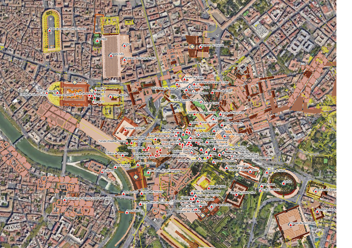
Screenshot of RomaGIS superimposing satellite image, archaeological data and monument names.Screenshot of RomaGIS superimposing satellite image, archaeological data and monument names.
It is managed using the free and open source GIS software.